EasyGSH-DB_Logo
EasyGSH-DB
Creation of application oriented synoptic reference data on geomorphology, sedimentology and hydrodynamics in the German Bight

The coastal area of the German Bight is characterized by diverse formation of islands, mud flats, tufts and estuaries. As a result, complex, non-linear transformations of tidal and sea processes from open North Sea to the coast and into estuaries take place.

This hydro-, sediment- and morphodynamically active area is intensively used as settlement area, as recreational area, as nature reserve and also as economic area. In particular, for the Marine Strategy Framework Directive (MSFD) (2008) comprehensive data on hydrographic changes should be provided. In order to continue to ensure an environmentally friendly supply and to ensure legal and planning security for infrastructure projects in marine and coastal zone, it requires interdisciplinary and continuous research to expand the knowledge of natural environment, natural process chains and their response to anthropogenic interventions.

Maps Download Closing event

Structur and work packages

icon modell

Creation of quality-assured datasets for the German Bight

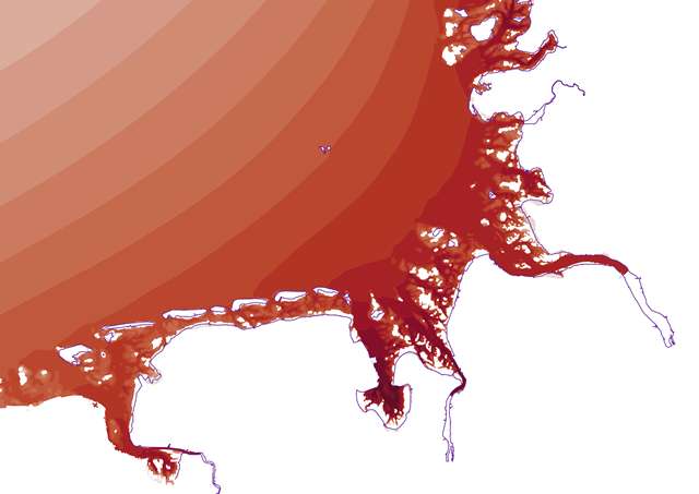
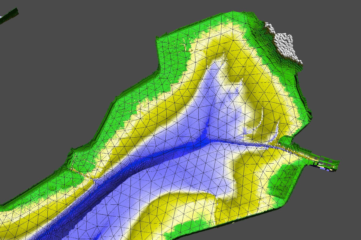
A data and method bank will be set up for seafloor, which will describe compiled natural data as a time-varying digital geomorphological model. This allows planar interpolation and semi-automatically produced consistent models and maps for relationship between geomorphology, hydrodynamic, sediment composition, and their dynamics. For a period of 20 years, simulation models will be operated as part of multi-model approach and the quality of model results will be analyzed and documented.

icon analyse2

Data analysis on geomorphology, hydrodynamic, sediment and user structure

Based on model results, analyzes are carried out on a variety of morphological, hydrodynamic and sedimentological parameters. Products are consistent bathymetries, maps and models of dynamics of morphology, sediment and tide events. The participatory process identifies stakeholders and their needs for products.

icon person

Participatory development of prototypical applications

Due to intensive dialogue between stakeholders and project consortium, linking of requirements is promoted in the phase of participatory product development with possible solutions. Together, we will develop usable prototypical products for selected applications and ensure their usability in test runs.

icon visual2

Visualization, provision and storage of products

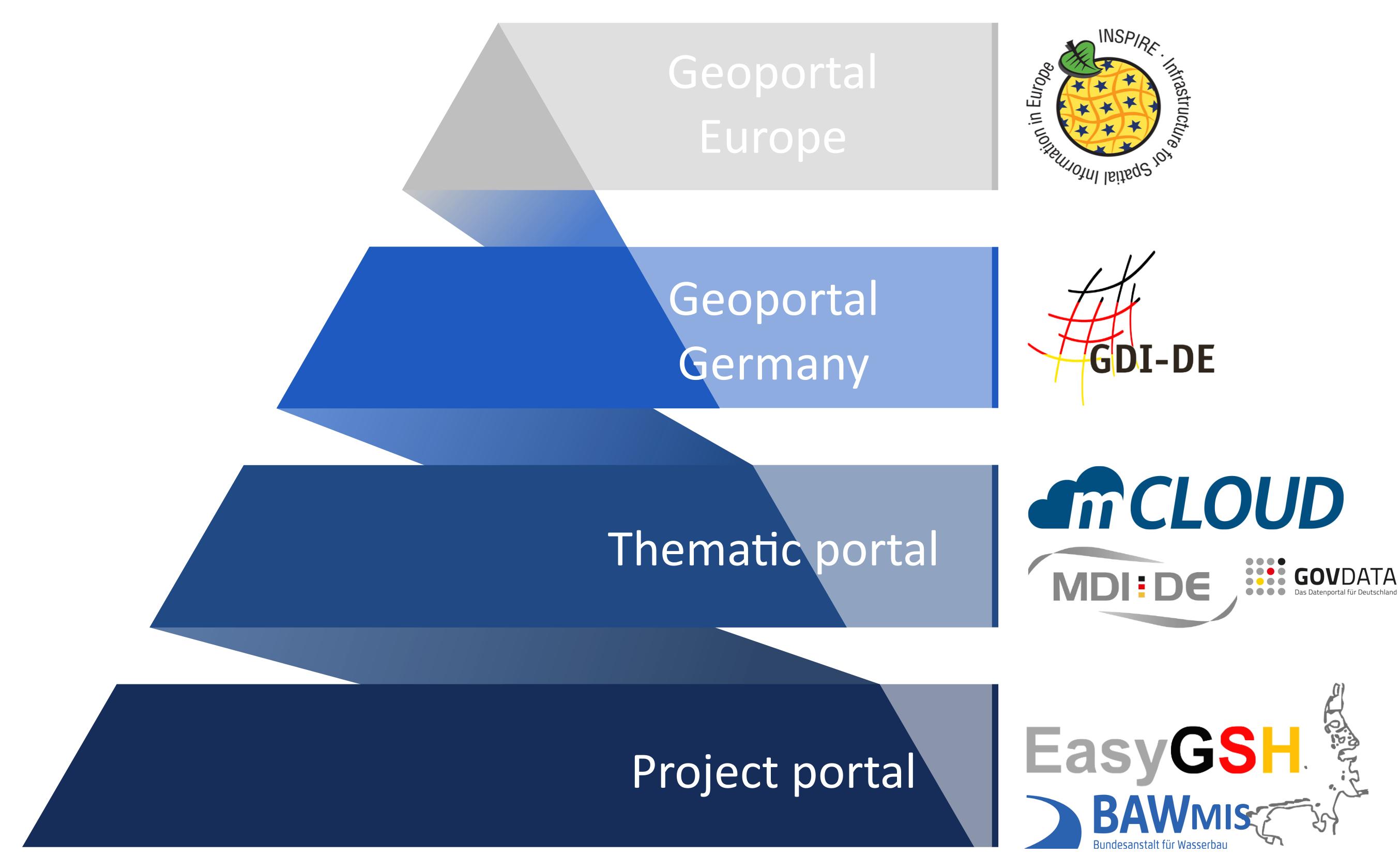
All products (data, methods, models, complex visualizations) are deployed on the platforms of EasyGSH-DB (data and information portal) and merged into MDI-DE and mCLOUD based on a distributed database. They contained metadata is according to currently valid standards (INSPIRE, WSV) as well as proof of origin and processing. The offer is complemented by an information portal applications on selected topics.

Goals

goals from EasyGSH-DB

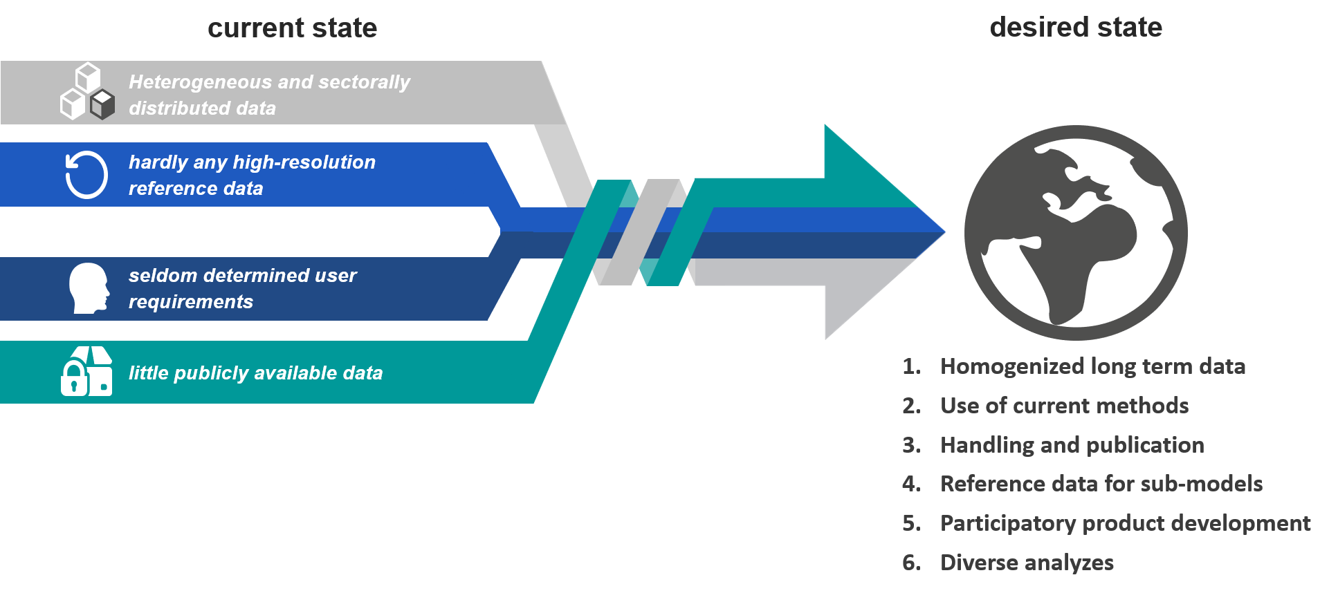
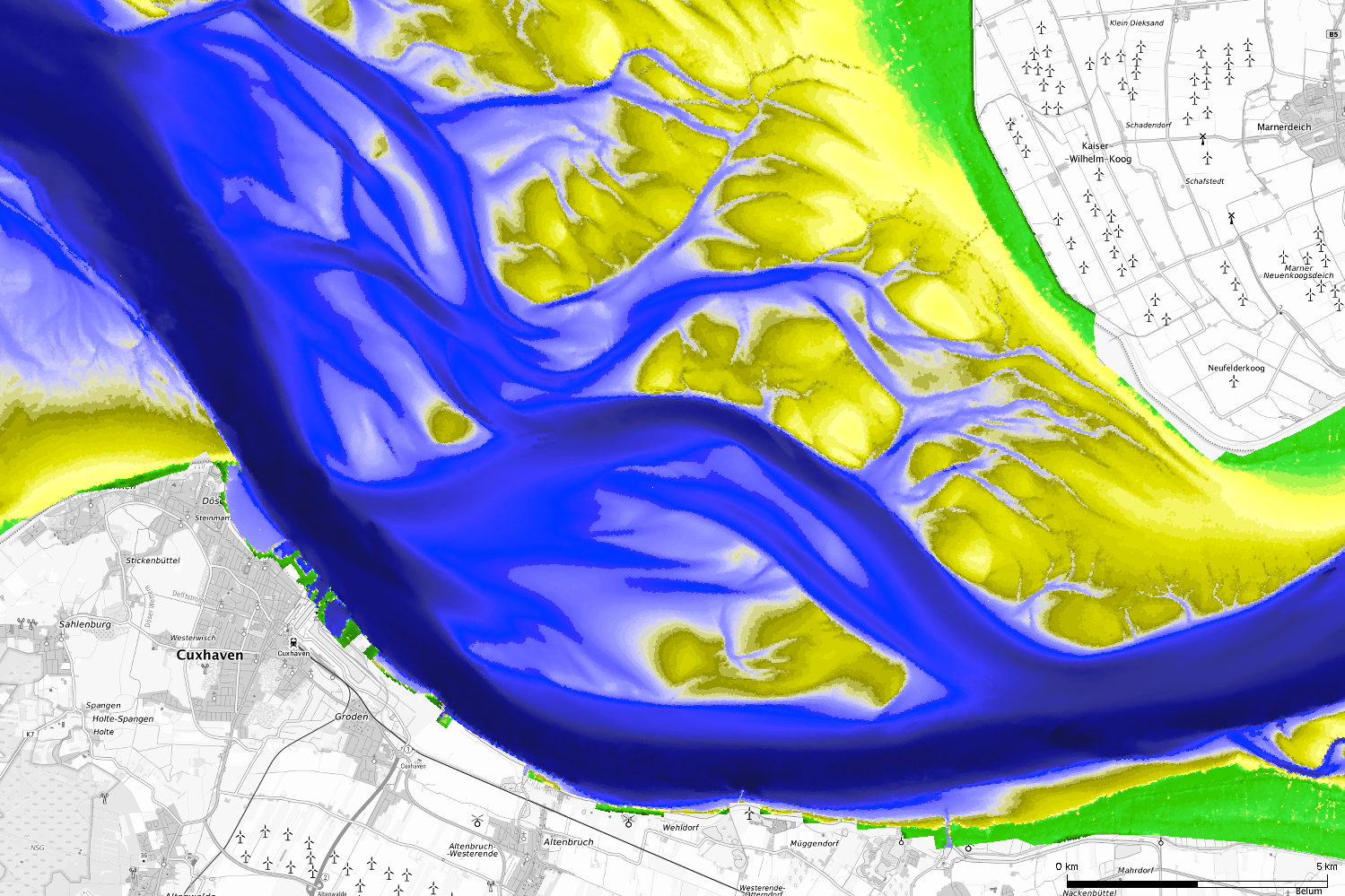
The aim of the project is to generate quality assured high-resolution reference data sets for the area of the German Bight by using available measurements, hydrodynamic simulations and analysis and make them accessible in a simple way.

Geodata and products prepared in the framework of EasyGSH-DB are provided via existing structures of the Maritime Data Structure Germany (MDI-DE) as well as information systems of the Federal Maritime and Hydrographic Agency (BSH) and the Federal Ministry of Transport and Digital Infrastructure (mCloud), thus guaranteeing practical and long-term availability.

For the first time, practice-oriented application options are systematically developed and prototypically implemented through close cooperation with future users. The early involvement of stakeholders and organization of a participatory process that continues over the entire duration of the project ensure focus on practice-relevant products.

The work focuses on geomorphologic data for bathymetry, sedimentology and data for hydrodynamics, salt and sediment transport as well as sea state. The project structure of EasyGSH-DB therefore offers possibilities for a large number of stakeholders from administration, maritime industry, research, non-governmental organizations and interested population to work proactively on product development of high-resolution, quality-assured databases.

Interactiv map viewer

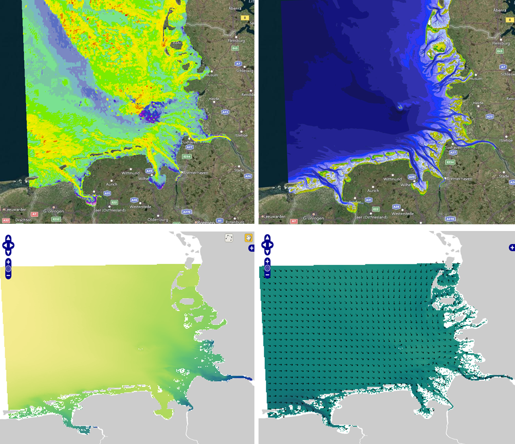
The map viewer is intended to provide an overview of some EasyGSH-DB products for users. The map tool can be accessed with the button "to the viewer for analysed data", project-related prototypical data of bathymetries, sediment parameters and hydrodynamic data are presented by a web map service (WMS).

icon weißes Auge to viewer for analysed data

In a second viewer we explicitly present synoptic data based on netCDF. Hydrodynamic data is presented in the viewer for synoptic data. It is selected data, due to data size of the netCDF files. The data visualized in the viewer is available for download.

icon weißes Auge to synoptic Hydrodynamic


Viewer_Beispiele

WMS / WFS / WCS are offered for use of EasyGSH geodata in other web or desktop applications. Desired data can be integrated into your own GIS applications using following URLs. Change year for web services to integrate hydrodynamics.

  • Web-Map-Service (WMS)
  • Bathymetry und Isolines
    https://mdi-dienste.baw.de/geoserver/EasyGSH_Bathymetrie/wms
  • Sedimentology
    https://mdi-dienste.baw.de/geoserver/EasyGSH_Sediment/wms
  • Hydrodynamic
    https://mdi-dienste.baw.de/geoserver/EasyGSH_Kennwerte_year/wms
  • Prototype products
    https://mdi-dienste.baw.de/geoserver/EasyGSH_ProtoProdukte/wms
  • Web-Feature-Service (WFS)
  • Bathymetry and Isolines
    https://mdi-dienste.baw.de/geoserver/EasyGSH_Bathymetrie/wfs
  • Sedimentology
    https://mdi-dienste.baw.de/geoserver/EasyGSH_Sediment/wfs
  • Hydrodynamic
    https://mdi-dienste.baw.de/geoserver/EasyGSH_Kennwerte_year/wfs
  • Prototype products
    https://mdi-dienste.baw.de/geoserver/EasyGSH_ProtoProdukte/wfs
  • Web-Coverage-Service (WCS)
  • Bathymetry
    https://mdi-dienste.baw.de/geoserver/EasyGSH_Bathymetrie/wcs
  • Sedimentology
    https://mdi-dienste.baw.de/geoserver/EasyGSH_Sediment/wcs
  • Hydrodynamic
    https://mdi-dienste.baw.de/geoserver/EasyGSH_Kennwerte_year/wcs
  • Note:

    Due to the GeoTiff size it can happen that GIS programs do not load data completely on the first attempt, so that "0" values are displayed, then reload WCS.

Download

ccby4.0 All products from EasyGSH-DB are available in sense of 4.0 International (CC BY 4.0), provided the name is given. For the first time, EasyGSH-DB provides synoptic model data in addition to analysis data. With these netCDF files, users can e.g. start their own models or analyzes. All synoptic data can be viewed beforehand in a viewer and are rasterized to a resolution of 1000m.

Geomorphologie

Geomorphology

- Bathymetry (1996-2016)

- Morphological drive

- Morphological space

- Isolines (1996-2016)

and more

to download
Sedimentologie

Sedimentology

- Petrographic maps

- D50 - grid

- D50 - Isoline

- Sorting

and more

to download
Hydrologie

Hydrodynamic

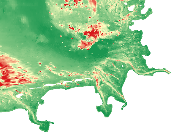
tidal characteristic numbers

- water level

- current velocity

- eff. bed shear stress action

and more

to Hydrodynamic to synoptic Hydrodynamic
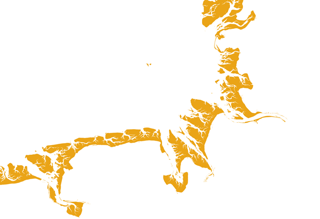
Prototypische Produkte

Prototype products

- Eulitoral (2002)

- Eulitoral (2012)

- Mudflat areas (2004)

- Mudflat areas (2014)

- Shell potential areas (2012)

to download
20
Years
72+
Shapes
1000+
GeoTIFFS
80+
Zips

Information portal

Informationsportal

Aim of the information portal is to provide documentation of specific information about generation process and data from EasyGSH-DB. In particular, "lineage" and "keywords" information stored in metadata should be used and support development of a thematic map. Then links of "encapsulated" learning objects with metadata should ensure reusability.

Publications

I. Workshops und closing event

1. Stakeholder Workshop

23. March 2018 - Introduction EasyGSH-DB

EasyGSH Einführung (Ger.)

Teilprojekt EasyGSH_Boden (Ger.)

Teilprojekt EasyGSH_Dialog (Ger.)

Teilprojekt EasyGSH_ModLearn (Ger.)

Teilprojekt EasyGSH_ModPort (Ger.)


II. Poster and Newsletter

mFund

mCLOUD Konferenz 2017

Poster

Poster (Engl.)

IMDIS

IMDIS 2021

Poster (Engl.)

III. Publications

Publications

Forschungs Express BAW - 27/2018 - EasyGSH-DB - 1. März 2018 (Ger.)

Forschungs Express BAW - 114/2018 - EasyGSH-DB - 25. Dezember 2018 (Ger.)

Ahlhorn, F. et al. (2019): Big-Data Anwendung für die Deutsche Bucht. Schiff & Hafen Oktober 2019 (10): 36-38. https://www.schiffundhafen.de (Ger.)

Plüß, A., (2019): Eine (Daten-) Flut für die Küste. BAWAktuell, 03/2019: 8-10. https://www.baw.de (Ger.)

Sievers, J. et al. (2021): An integrated marine data collection for the German Bight – Part 1: Subaqueous geomorphology and surface sedimentology (1996–2016). Earth Syst. Sci. Data, 13, 4053-4065, https://doi.org/10.5194/essd-13-4053-2021/a>

Hagen, R. et al. (2021): An integrated marine data collection for the German Bight – Part 2: Tides, salinity, and waves (1996–2015). Earth Syst. Sci. Data, 13, 2573–2594, https://doi.org/10.5194/essd-13-2573-2021

Presentations

Hagen, R., et.al., (2018), Impact of small bathymetric changes on large-scale hydrodynamics, PECS - Galveston, Texas

Ihde, R., et.al., (2019), Big Data - Analysen von Geodaten als Basis für Planungsaufgaben, Wissenschaft und Umwelteinschätzungen, INTERGEO - Stuttgart (Ger.)

Validation document

Hagen, R., et.al., (2019), Validierungsdokument - EasyGSH-DB - Teil: UnTRIM-SediMorph-Unk, doi: https://doi.org/10.18451/k2_easygsh_1 (Ger.)

Freund, J., et.al., (2020), Flächenhafte Analysen numerischer Simulationen aus EasyGSH-DB, doi: https://doi.org/10.18451/k2_easygsh_fans_2 (Ger.)

Annual data sheets - extract of validation document

Bundesanstalt für Wasserbau, 2019, Jahreskennblatt Jahr - Kurzfassung der Validierung, doi: https://www.doi.org/10.18451/k2_easygsh_jkbl_(1996-2015) (Ger.)

1996 1997 1998 1999 2000 2001 2002 2003 2004 2005 2006 2007 2008 2009 2010 2011 2012 2013 2014 2015

Scientific report

Plüß, A., et.al., (2020), Wissenschaftlicher Abschlussbericht zum mFUND-Projekt: EasyGSH-DB, https://doi.org/10.2314/KXP:1744505187 (Ger.)

Plüß, A., et.al., (2020), Scientific final research report for mFund-Project: EasyGSH-DB
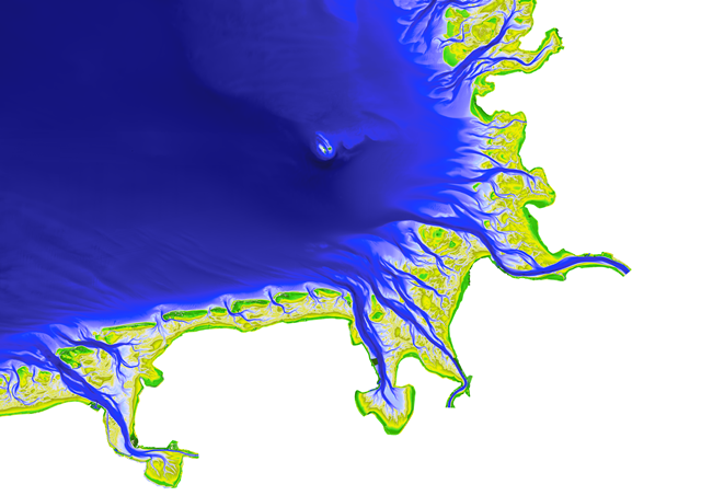
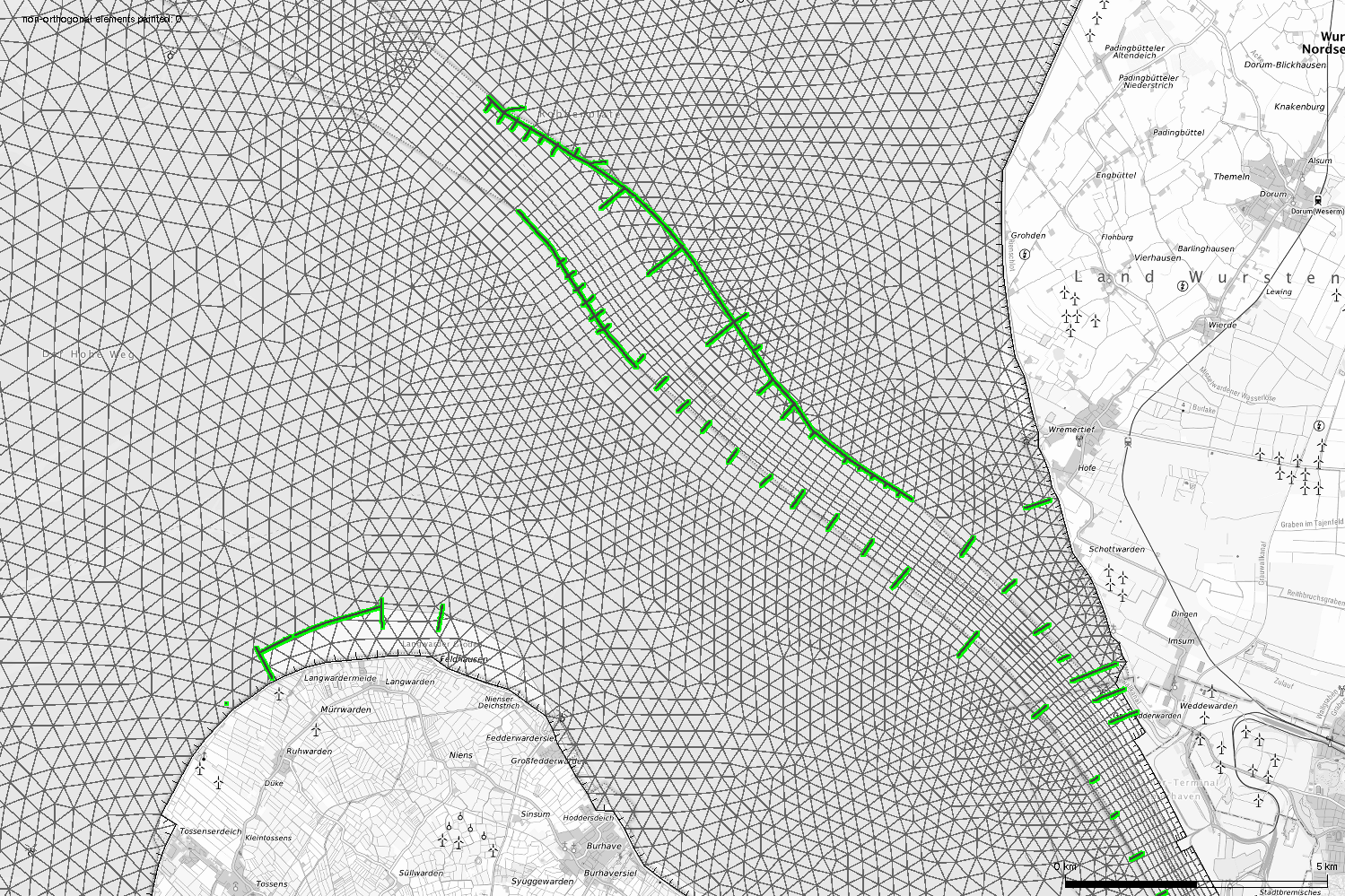
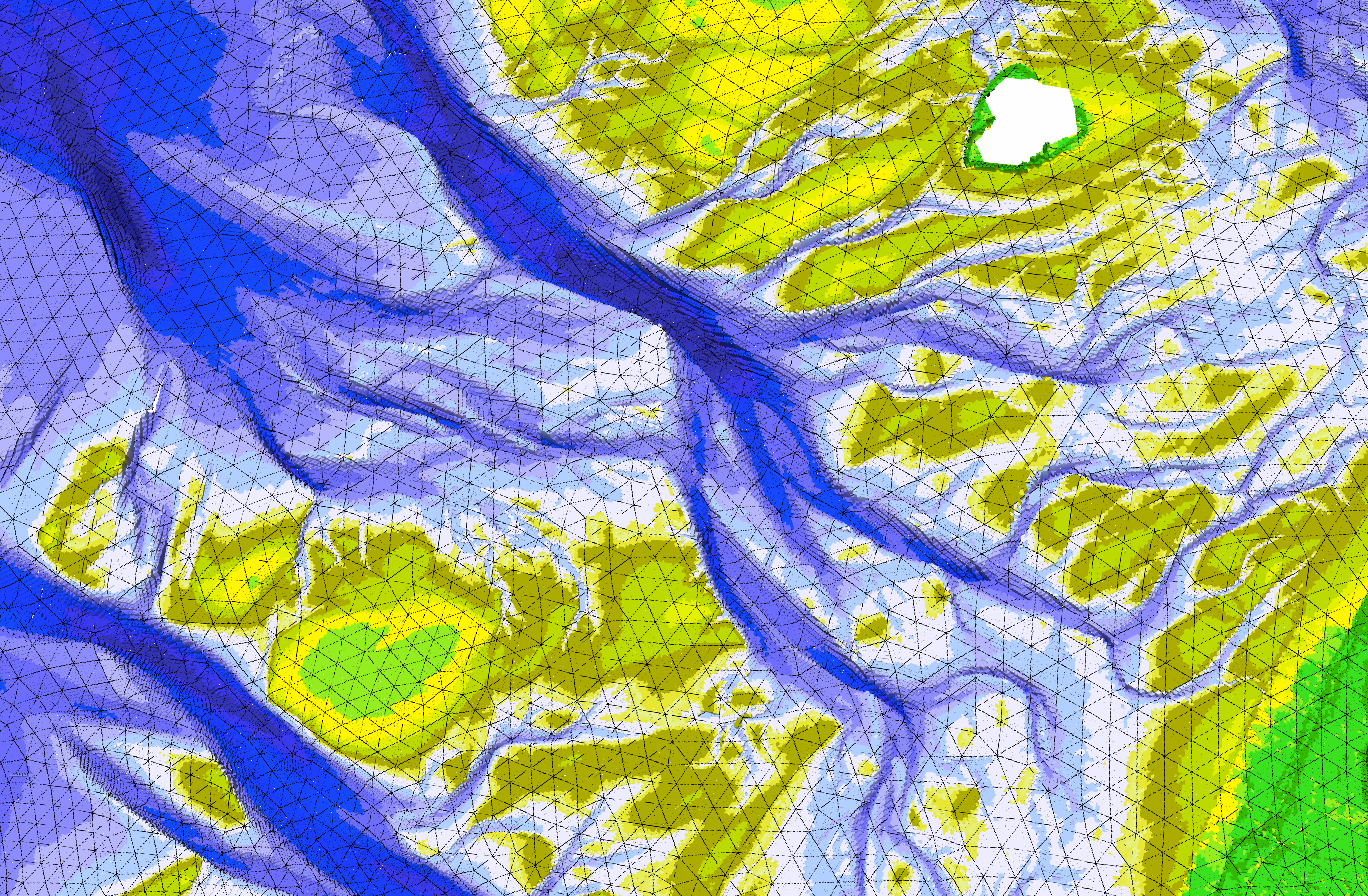
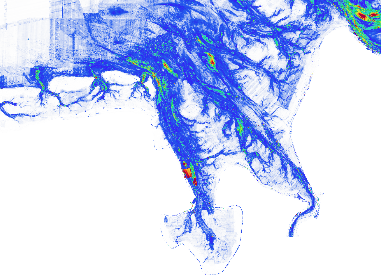
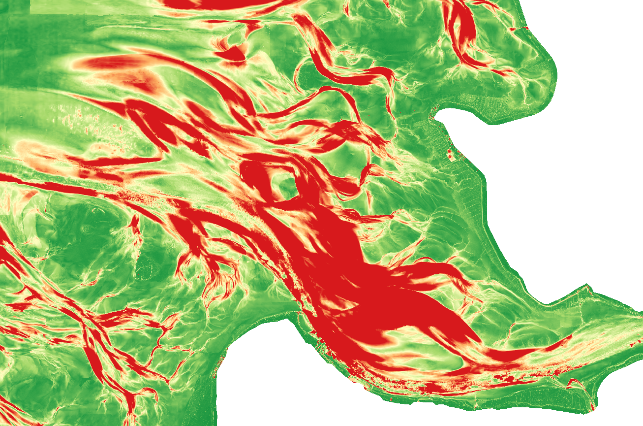
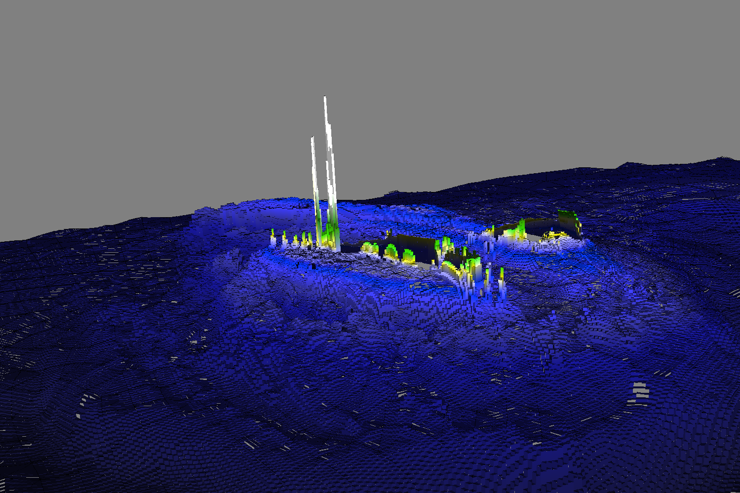
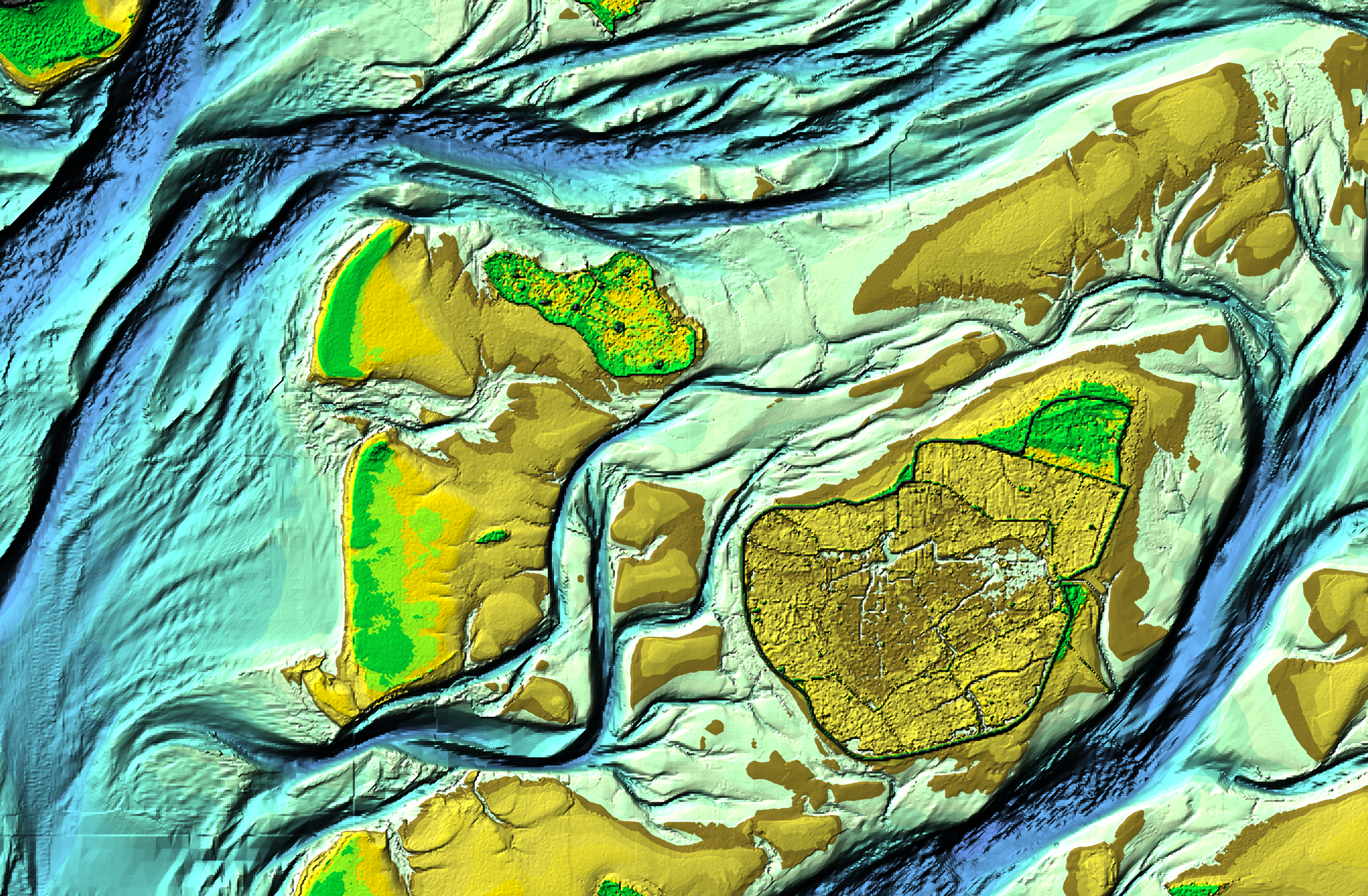
How-to-cite:
For the use of EasyGSH-DB data products in publications (articles, papers, reports, books, and data products derived from EasyGSH-DB products), all users are subject to the provisions of CC BY 4.0.
To cite the EasyGSH-DB hydrodynamics or sea state products, please indicate: "The EasyGSH-DB products and metadata were obtained from the EasyGSH-DB portal www.easygsh-db.org ". In addition, the data description papers and the data DOI can be cited.

Sievers, J., Milbradt, P., Ihde, R., Valerius, J., Hagen, R., Plüß, A. (2021): An integrated marine data collection for the German Bight – Part 1: Subaqueous geomorphology and surface sedimentology (1996–2016). Earth System Science Data. https://doi.org/10.5194/essd-13-4053-2021

Hagen, R., Plüß, A., Ihde, R., Freund, J., Dreier, N., Nehlsen, E., Schrage, N., Fröhle, P., Kösters, F. (2021): An integrated marine data collection for the German Bight – Part 2: Tides, salinity, and waves (1996–2015). Earth System Science Data. https://doi.org/10.5194/essd-13-2573-2021

When using the data, cite the respective subject area data DOI:
Subject area - Geomorphology:
Sievers, J., Rubel, M., Milbradt, P. (2020): EasyGSH-DB: Themengebiet - Geomorphologie [Data set]. Bundesanstalt für Wasserbau. https://doi.org/10.48437/02.2020.K2.7000.0001

Subject area - Bathymetry:
Sievers, J., Rubel, M., Milbradt, P. (2020): EasyGSH-DB: Bathymetrie [Data set]. Bundesanstalt für Wasserbau. https://doi.org/10.48437/02.2020.K2.7000.0002

Subject area - Hydrodynamic:
Hagen, R., Plüß, A., Freund, J., Ihde, R., Kösters, F., Schrage, N., Dreier, N., Nehlsen, E., Fröhle, P. (2020): EasyGSH-DB: Themengebiet - Hydrodynamik [Data set]. Bundesanstalt für Wasserbau. https://doi.org/10.48437/02.2020.K2.7000.0003

Subject area - synoptic Hydrodynamic:
Hagen, R., Plüß, A., Schrage, N., Dreier, N. (2020): EasyGSH-DB: Themengebiet - synoptische Hydrodynamik [Data set]. Bundesanstalt für Wasserbau. https://doi.org/10.48437/02.2020.K2.7000.0004

Subject area - Sedimentology:
Sievers, J., Rubel, M., Milbradt, P. (2020): EasyGSH-DB: Themengebiet - Sedimentologie [Data set]. Bundesanstalt für Wasserbau. https://doi.org/10.48437/02.2020.K2.7000.0005

To cite the final scientific report:
Plüß, A.; Hagen, R.; Ihde, R.; Freund, J.; Kösters, F.; Milbradt,P.; Sievers, J.; Nehlsen, E.; Schrage, N.; Dreier, N.; Fröhle, P.; Ahlhorn, F.; Meyerdirks, J. (2020): Wissenschaftlicher Abschlussbericht zum mFUND-Projekt: EasyGSH-DB. https://doi.org/10.2314/KXP:1744505187

EasyGSH-DB on other Platforms
Researchgate KFKI mFund

IV. Metadata

Metadaten_pyramide

From the start of the project, metadata was recorded to ensure long-term useability and traceability. Metadata is automatically recorded in the netCDF header for synoptic data and manually for products. Product metadata is linked to direct downloads and, if available, to additional information such as the validation document for the model and the annual information sheets. Metadata for products are offered as PDF or XML in the download area. Via Harvest of CSW (Catalog Service for the Web) interface of BAW on the which metadata acquisition system NOKIS (North and Baltic Sea Coastal Information System) is located, metadata is harvested to mCLOUD (www.mcloud.de), MDI-DE (www.mdi-de.org), GovData (www.govdata.de) and GDI-DE (www.geoportal.de). Data from EasyGSH-DB appears in Geoportal Europa - INSPIRE by querying from GDI-DE. As a result, metadata comply with applicable standards (INSPIRE, GDI-DE, WSV) and include quality evidence of origin and processing processes. This network of connections ensures web-based provision of data for experts and public.

ausgewähltes image1

5
Projectpartner
900+
Data
25+
Stakeholder
3
Workshops

Projectpartner

The project EasyGSH-DB consists of different partners with respective subprojects.

Banner mit Partnerlogos

Bundesanstalt für Wasserbau (BAW) - Federal Waterways Engineering and Research Institute - EasyGSH_ModPort -
icon ort schwarz Dienststelle Hamburg, Wedeler Landstraße 157, 22559 Hamburg - contact

smile consult GmbH (smile) - EasyGSH_Boden -
icon ort schwarz Schiffgraben 11, 30159 Hannover - contact

Technische Universität Hamburg (TUHH) - Hamburg University of Technology - EasyGSH_ModLearn-
icon ort schwarz Denickestraße 22, 21073 Hamburg - contact

Küste und Raum GdR (KuR) - EasyGSH_Dialog -
icon ort schwarz Katrepeler Landstr. 27, 28357 Bremen - contact

Bundesamt für Seeschifffahrt und Hydrographie (BSH) - Federal Maritime and Hydrographic Agency -
icon ort schwarz Bernhard-Nocht-Straße 78, 20359 Hamburg - contact

Subprojects

Preparation, analysis and provision of geomorphological data of the German Bight

"Quality-assured ground data": The importance of data and information about waterbed has grown steadily in recent decades. They are in particular requested by maritime industry, planning offices, ecologists, but also by federal and state authorities to fulfill their tasks. The sea survey data and sedimentological data (sediment samples and side-view sonar recordings and maps) available from federal authorities and administrations are merged to form a quality-assured database-based simulation model of the water surface of the German Bight. Consistent area wide sedimentological and geomorphological base products, such as e.g. annual bathymetries are created.

"Analysis of ground data and derivation of products": This sub goal focuses on derivation of complex geomorphological products (depth differences, hypsometries, animations, maps of sediment properties). In addition, methods for spatial interpolation of particle size distributions depending on seabed facies and hydrodynamic system are improved, carried out and results are offered as products. By way of example, it should be examined to what extent a time variant surface sediment distribution can be calculated by combining morphological time series. Conceptual analyzes are also intended to capture relationships between ground data and hindcast modeling results. The results are classifications and descriptions of different types of seabeds according to ground physical, hydro- and sediment dynamic properties in form of maps and texts as well as resulting function as habitat, resource or subsoil.

"Data storage and publication": The easy accessibility and searchability of collected data and created products is an essential prerequisite for acceptance and use by target groups addressed in overall target. For this purpose, suitable previews and download components are developed and integrated into infrastructures of the established Internet portals in the business area of the BMVI.

Contact person: apl. Prof. Dr.-Ing. habil. Peter Milbradt

Stakeholders/Requirements and Participatory Product Development

As part of the subproject EasyGSH-DB_Dialog of the joint project EasyGSH-DB, a participation process is organized and carried out by the company Küste und Raum over the entire duration of the project. A mutual exchange between partners of the consortium and potential users of data is used to organize a proactive mediation of demand and possible offers. The aim is to identify solutions for a representative selection of requirements together with potential users and to develop them in practice. The tasks of the company Küste und Raum are mainly aimed at communication between project consortium and stakeholders. In the first phase of the project, relevant stakeholders and their needs for products are identified in order to be able to develop selected products as prototypes in the second project phase as part of participatory product development.

Important target groups for use of marine geodata are federal, state and municipal administrations (Transport and environment ministries, coastal protection and environmental authorities, etc.), public institutions from research (oceanography, coastal engineering, environmental sciences, etc.), as well as the public, consisting of NGOs (environmental associations, environmental organizations, tourism, sailing association, etc.) and the economy (energy producers, engineering firms, fisheries, etc.). The aim is to include as many relevant groups as possible in the participation process.

To ensure this, an extensive analysis is carried out in the first phase of the process:

  • which are already existing products that are currently available from project partners but also from other sources on the topics of geomorphological and hydrological baseline data,

  • which relevant stakeholders for the German Bay area are to include. The degree of further involvement in the project is determined in consultation with consortium partners and willingness of identified stakeholders.

  • needs of identified stakeholders. For this purpose, selected stakeholders are consulted in form of structured interviews and questioned about needs and existing deficits.

  • identified product needs resulting from analysis of needs and deficits. In a coordination process conducted in collaboration with stakeholders and consortium partners, products (to be developed) are selected.

In the second phase of the project, participatory product development will be carried out for selected product needs based on analyse results. The goal is to develop applications and practicable solutions together with stakeholders. The previous phase of dialogue is mainly about close interaction between project consortium and users of the to be developed products. In order to develop user friendly products that are specific to respective needs, this exchange is organized in form of one on one discussions and workshops with respective stakeholders. In the subsequent phase of prototyping, further development into prototypical products for selected use cases takes place. The usability is ensured by an interactive vote on the basis of test runs, in which all consortium partners and relevant stakeholders are involved.

Contact person: Dr. Jürgen Meyerdirks

Creation of synoptic reference data of hydrodynamics, sediment transport, sea state and creation of a supportive e-learning platform

The tasks of Institute of Hydraulic Engineering of the Technical University of Hamburg (TUHH-WB) focus on model based determination and provision of quality assured temporally and spatially highly resolved hydrodynamic, morphodynamic conditions and salinity in the German Bight for the period 1996 to 2015 as basis for target group-specific applications. For this purpose, the model chain Telemac - Sisyphe - Tomawac is used as part of a multimodel approach, as well as the SWAN model for the sea state.
In addition to actual operation of models, an essential part of the work will be quality assurance of results by direct comparison with calculation results of BAW (see lead application). Within the scope of multimodel approach, the TUHH carries out three-dimensional simulations of hydrodynamics and seaway as well as salt and sediment transport with Telemac / Sisyphe / Tomawac. It is expected that ongoing comparison of work results in the project will produce quality assurance methods that can only be achieved on basis of ongoing comparisons of work results, and which will ensure that, in the future, for both the project partners and other institutions the quality of model results can be significantly improved.

The Telemac model chain used in this subproject of the TUHH consistently uses finite element method to solve equations of motion. Furthermore, multi-model approach (the model chain of the BAW uses the finite difference method) makes it possible to compare model performance of different model families.

Contact person: Prof. Dr.-Ing. Peter Fröhle

Creation of synoptic reference data of hydrodynamics, sediment transport and sea state as well as their publication in specialized information portals

The subproject EasyGSH_ModPort is embedded in the mFUND joint project EasyGSH-DB and includes simulation runs and analyzes by BAW and TUHH. These form the basis for study of coastal hydrology issues and further investigations, which assume a spatially and temporally consistent basis of marine geo and hydrodynamics data. More specifically, work in this subproject focuses on the

  • Creation of quality-assured simulation data on hydrodynamics, salt / sediment transport and sea state parameters,

  • analysis of simulation data and derivation of products and

  • data management and publication.

"Simulation data": To characterize dynamic conditions in the German Bight, hydrodynamic measurement data, which as a rule are only available selectively, spatially and temporally interpolated via simulation models and thus created consistent reference datasets for the natural habitat of the German Bight. Data are first considered for a period of 20 years (1996 - 2015), which represent a complete nodal cycle of partial tides of the moon (18.6 years). They describe a sufficiently recent period, which is already sufficient for many questions and planning tasks. In addition to actual basic data, derived, characteristic quantities are also merged.

"Analysis of simulation data and derivation of products": Both desired high spatial and temporal resolution and quality of simulation data allow a variety of characteristic analyzes of water level, flow, salt and sediment transport as well as sea state and thus their changes over the years. This also concerns analysis and statistical evaluation of frequencies of hydrodynamic variables and assignment of occurrence probabilities. For detailed characterization of tidal dynamics, harmonic constants of water level and flow are documented.

"Data storage and publication": The easy access to data and products compiled as a digital catalog is an essential prerequisite for acceptance and use by the addressed target groups. For this purpose, IT infrastructure components used at BAW and BSH must be further networked, metadata and data services adapted and expanded, and simple entry points, previews and download components integrated.

Contact person: Dr.-Ing. Andreas Plüß

Contact

Thank you for your interest in the project EasyGSH-DB. If you have any questions about EasyGSH-DB and its products, please fill in the following contact form and send it to us. We process your requests in a timely manner.

By submitting the data entered in the contact form and clicking on "send now" button below, you declare that you have read the privacy policy and that you agree that the data provided will be collected and stored electronically. The data is used only strictly earmarked for processing and answering your request.

By submitting the contact form, you agree to the processing. You may revoke your consent at any time with future effect. In case of cancellation your data will be deleted immediately.